
3D Archaeological Scans of Giant’s Castle Maze by Archaeologist-Technologist Tom Goskar.
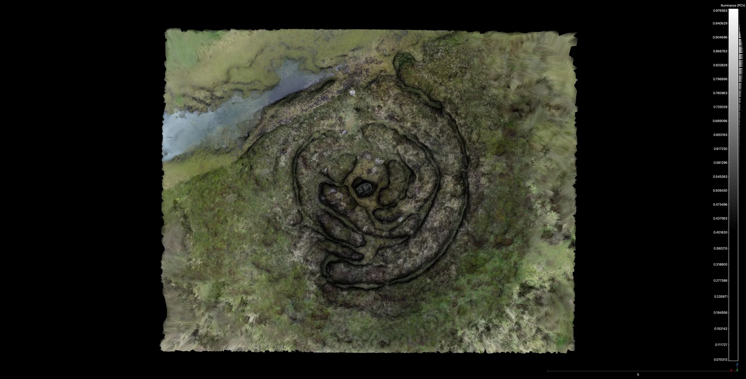
Some time ago I wrote about Tom and Tehmina Goskar visiting Giant’s Castle Maze with us to create some archaeological 3D scans of the site. The results of these scans have proved invaluable in deciphering the maze’s shape and deciding how to approach the restoration. The below digital model makes it possible to explore the maze in 3D - viewing it from all angles and showing the paths, the levels of erosion, and the few remaining stones:
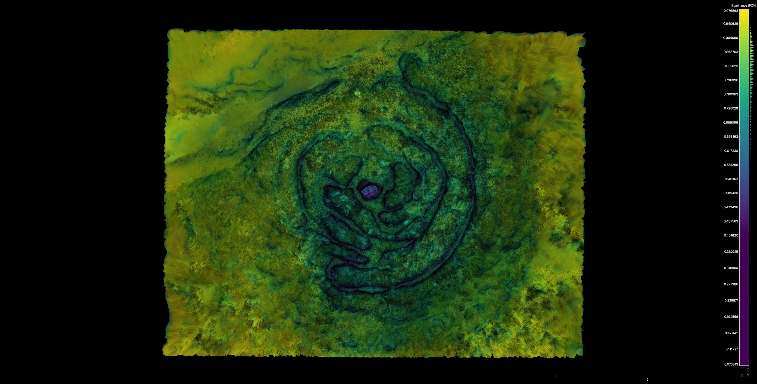
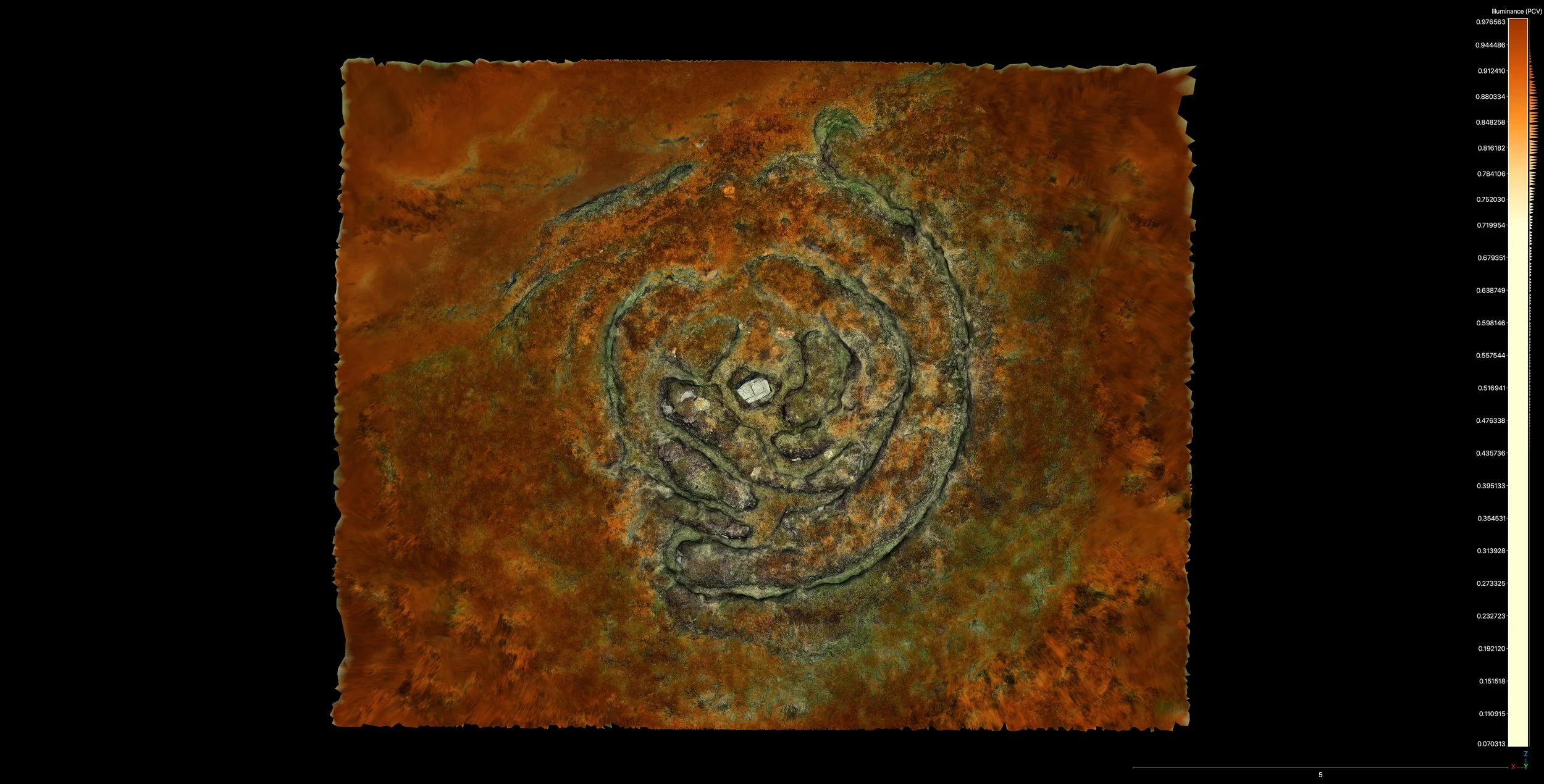
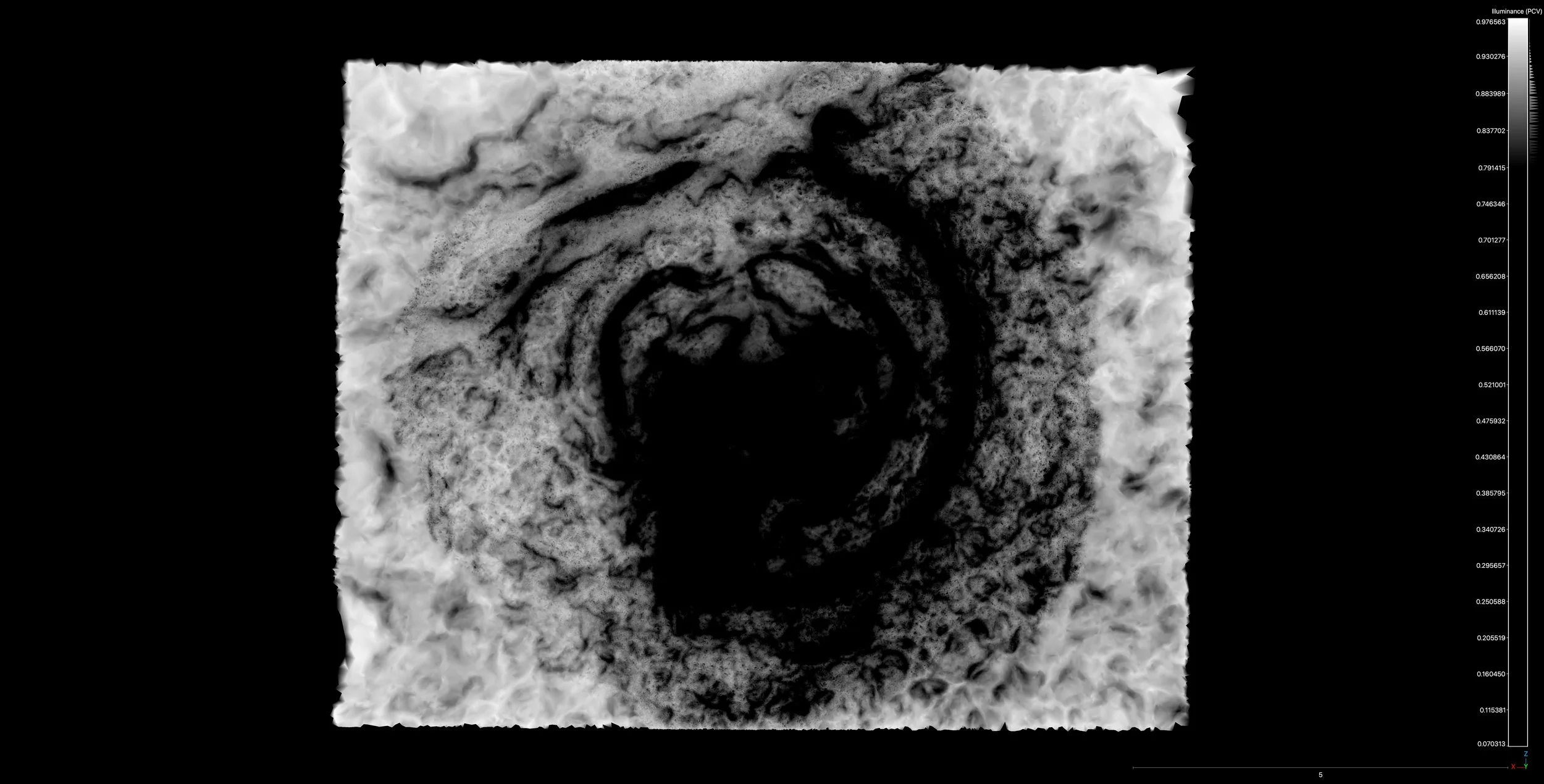
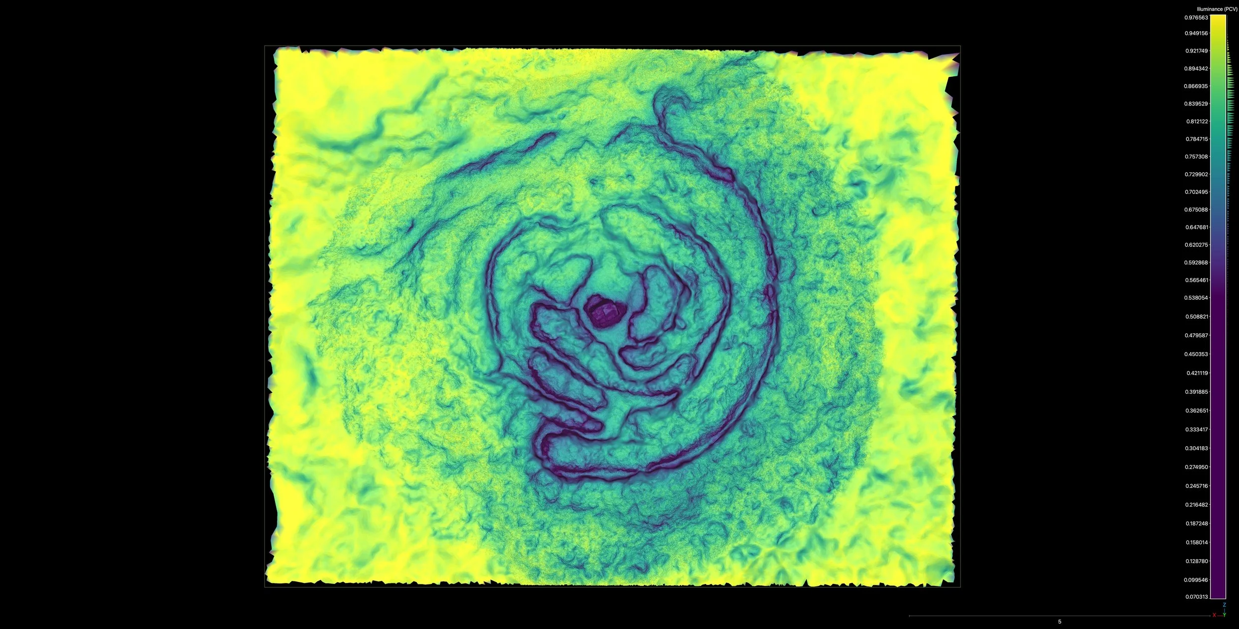
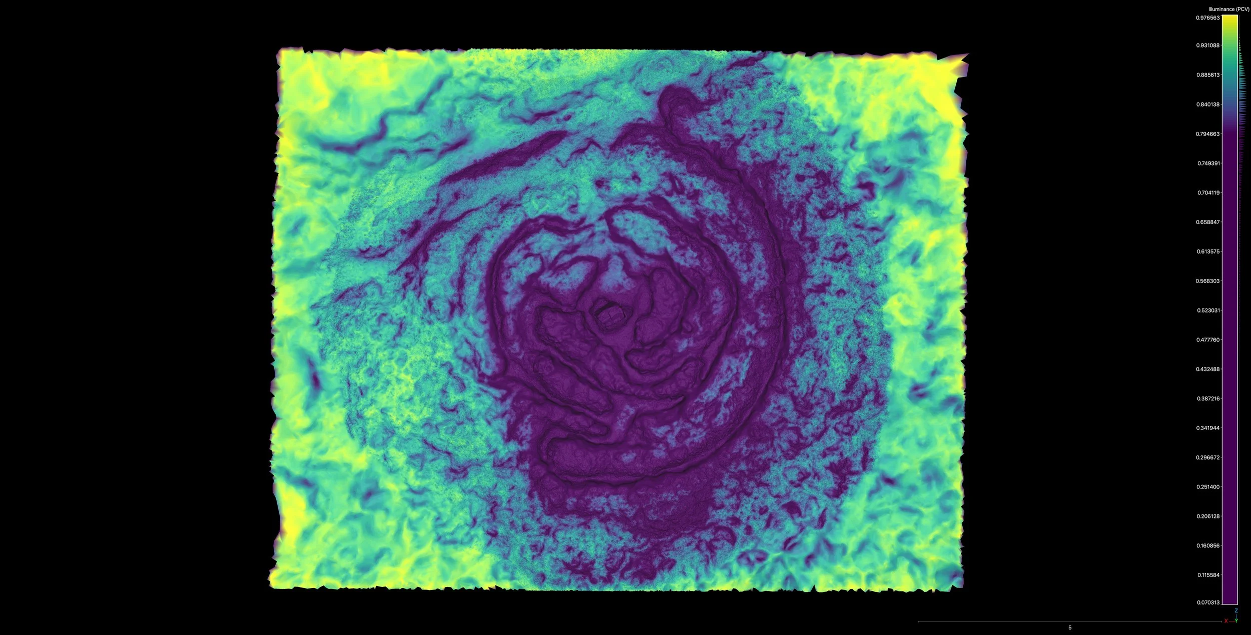
Before we even began considering these scans as incredibly useful tools, we were immediately struck by the sheer artistry of them. These animations show the site rendered by Tom in false colour to highlight the different features of the maze. The results are futuristic - almost psychedelic - and give this old site new and invigorating energy.
Tom rendered the maze using different techniques, revealing textural features that were invisible to the naked eye. These scans helped us to understand the high and low points of the maze, and the earlier shapes of the paths. What struck me most when I initially saw these scans - a quick glimpse on Tom’s phone in Old Town Café while we sheltered from the rain - was how visibly the maze stands out from the surrounding landscape.
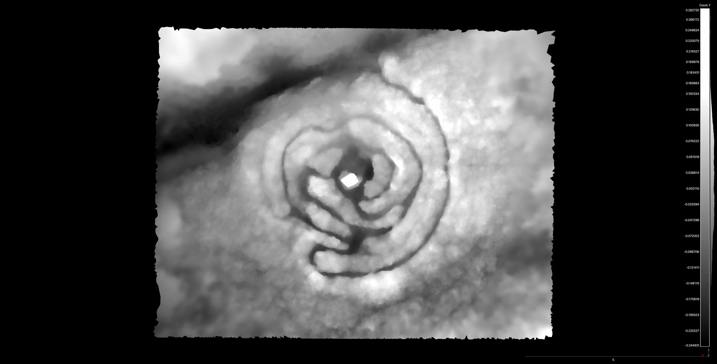
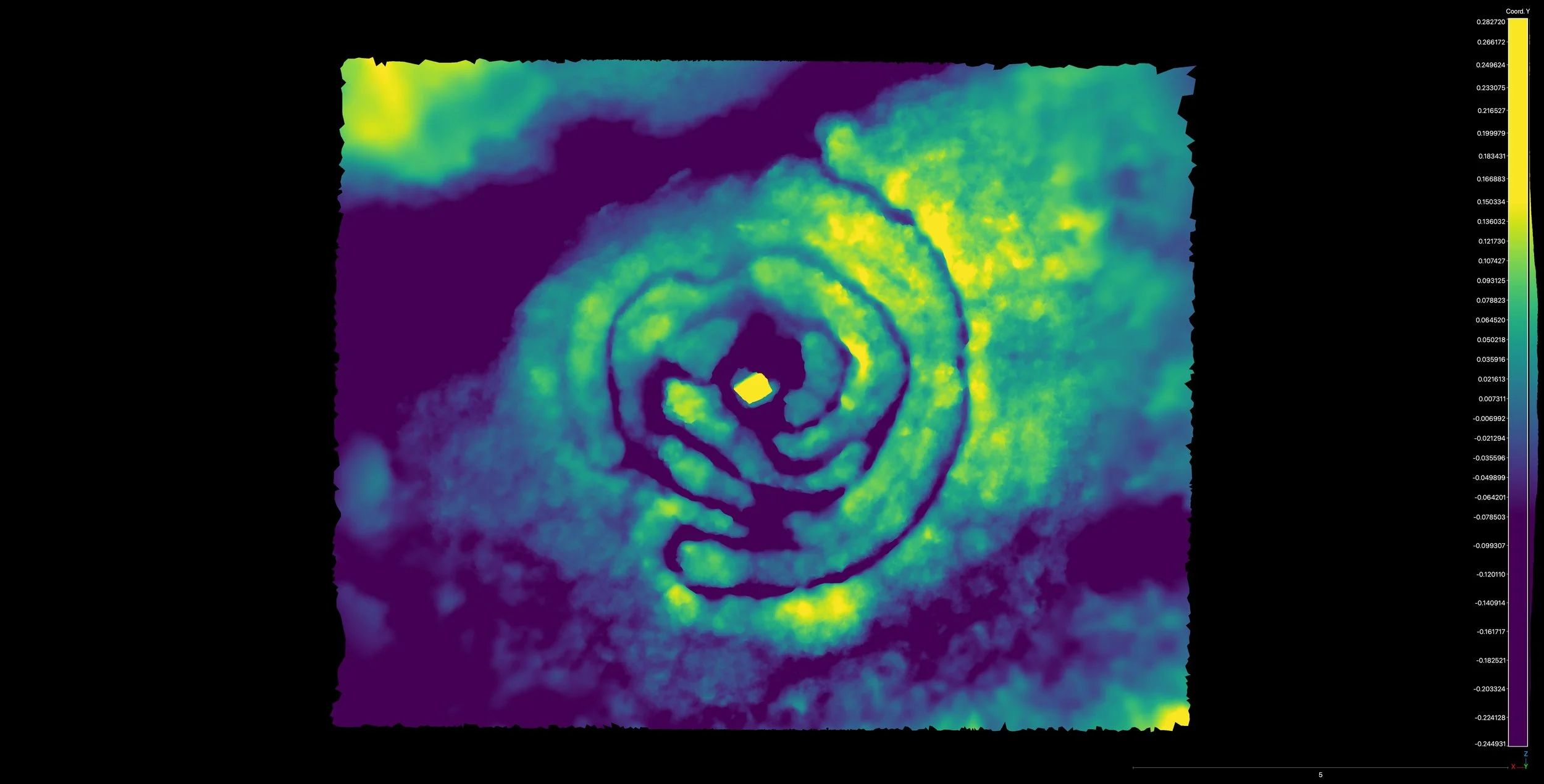

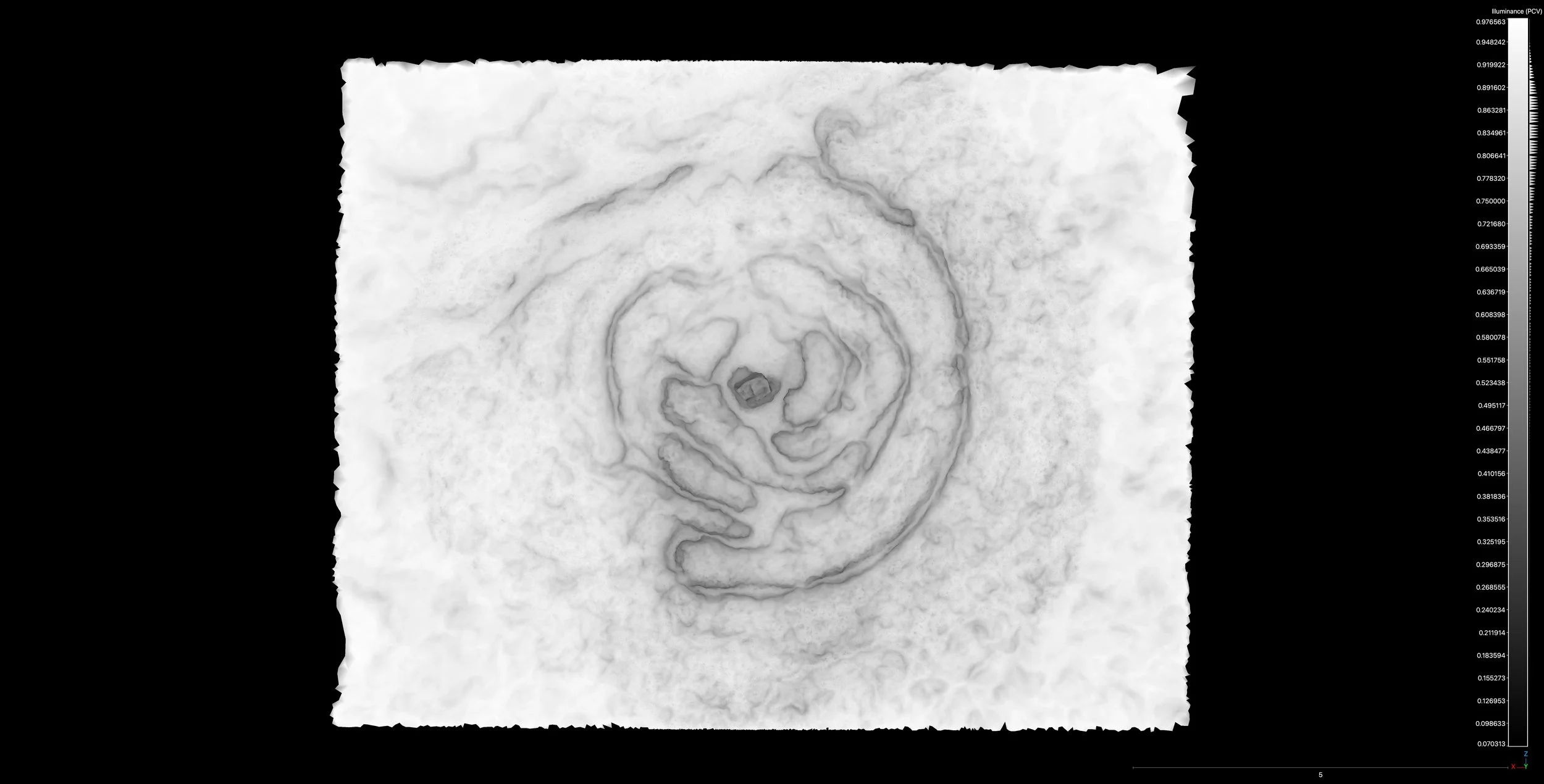
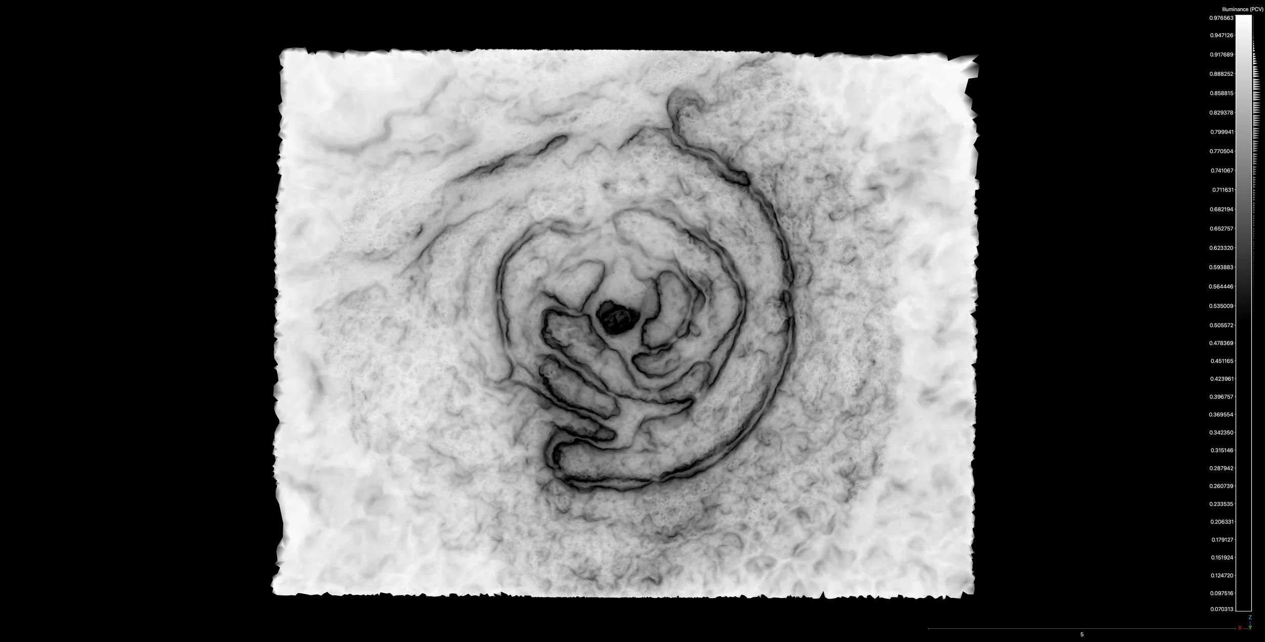
As I had watched this labyrinth become more and more overgrown as years went by, it felt as if it’s gradual decline and return to nature was somehow inevitable. But an archaeologist recently told me that once you change the ground, it is changed forever - those marks will always be there and it will never be the same as it was before. This was what Tom’s scans were revealing, the maze really was there - etched into the landscape by the actions of the original maze-makers (whoever they were) seventy years before. Furthermore, if we could read these scans right, it would be possible to follow these patterns to make the maze a usable labyrinth once more.
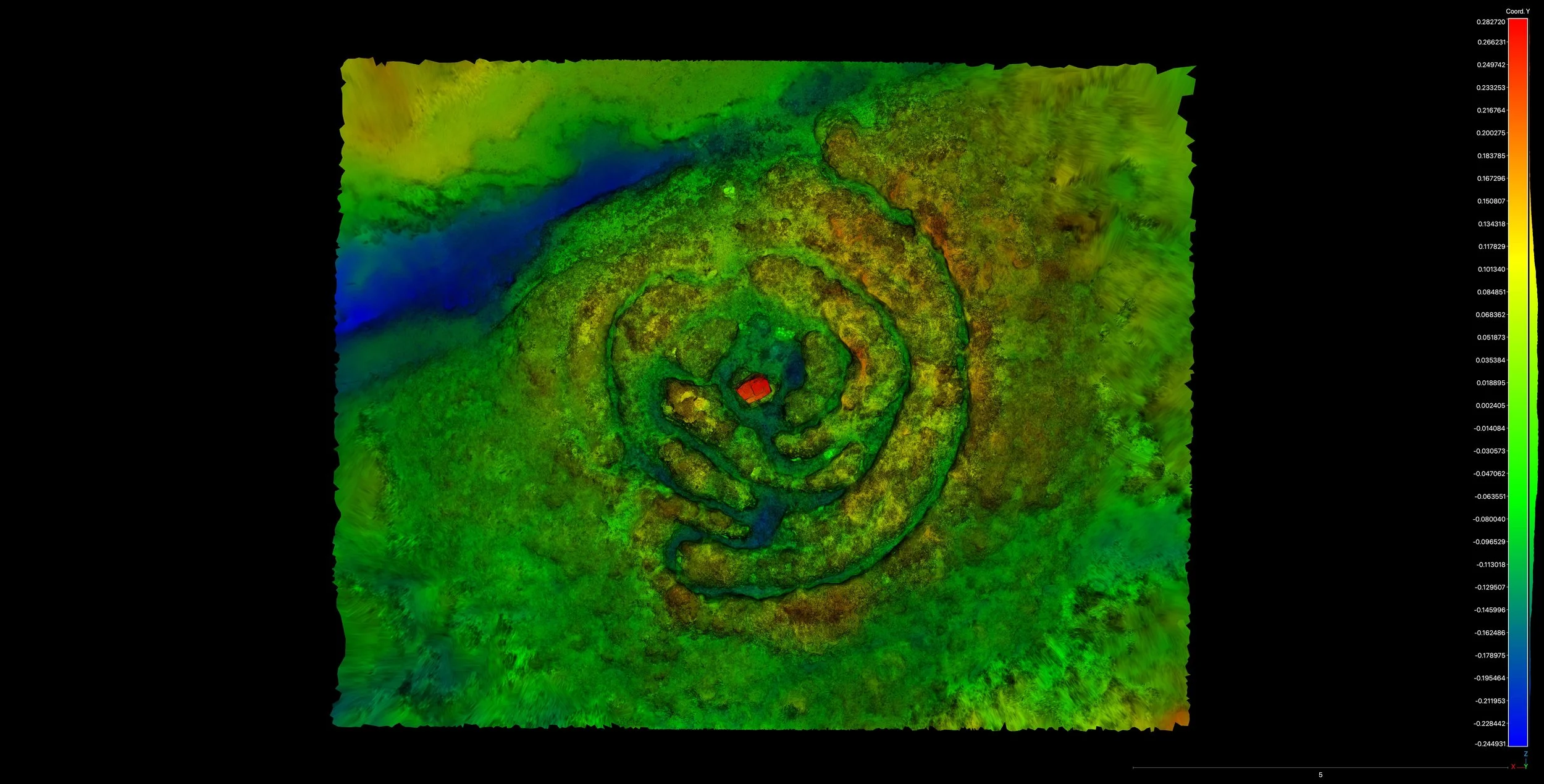
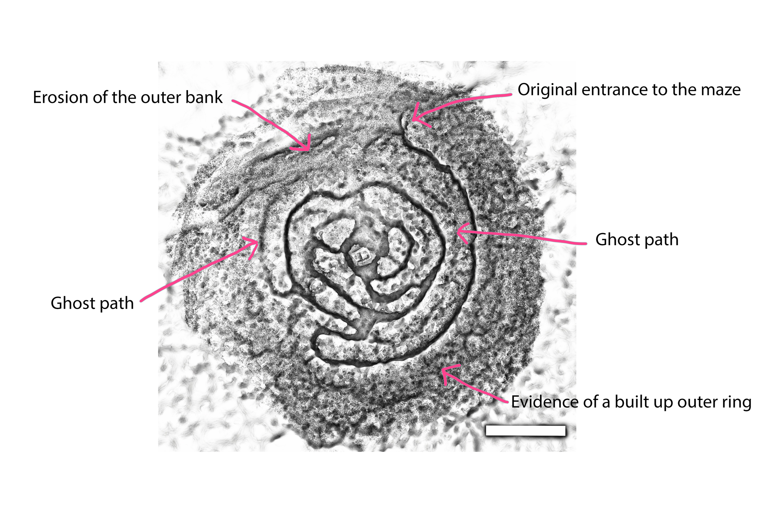
Pouring over these scans, we were able to decipher some clues to the maze’s earlier shape. We saw that the original entrance had actually been over towards the North East edge, and that the desire path that now leads straight to the centre of the maze is the result of the erosion of the outer bank, closest to the path, likely created by people walking over the edge of the maze to avoid the nearby puddle that forms in winter. The scans also revealed the presence of an outer bank, suggesting a possible outer ring of stones edging the maze, in addition to several “ghost paths” - remnants of earlier paths that have now become overgrown.
We were then able to compare these scans with the survey of Giant’s Castle Maze that Jeff Saward made in 1990, which confirmed the presence of a lot of these features, all of were far more visible thirty years ago. As well as these enduring features, this comparison showed us the extent of the erosion since 1990, when many more stones could clearly be seen beneath the peat.
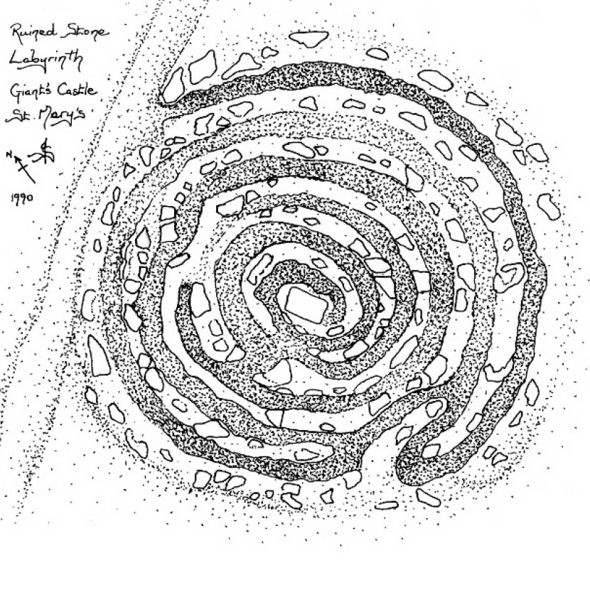
Giant’s Castle Maze Survey by Jeff Saward from The Isles of Scilly Troy Towns
Contemplating the changes that the maze has undergone in these intervening decades, I wonder what the labyrinth would look like in another thirty years, if left untouched? If this rate of change continued, it would probably be entirely unrecognisable as ever having been a maze at all.
Huge thanks to Tom Goskar for being involved in the project and for creating these incredible renderings.
For more of his work take a look at his website: https://tom.goskar.com/